Project Overview
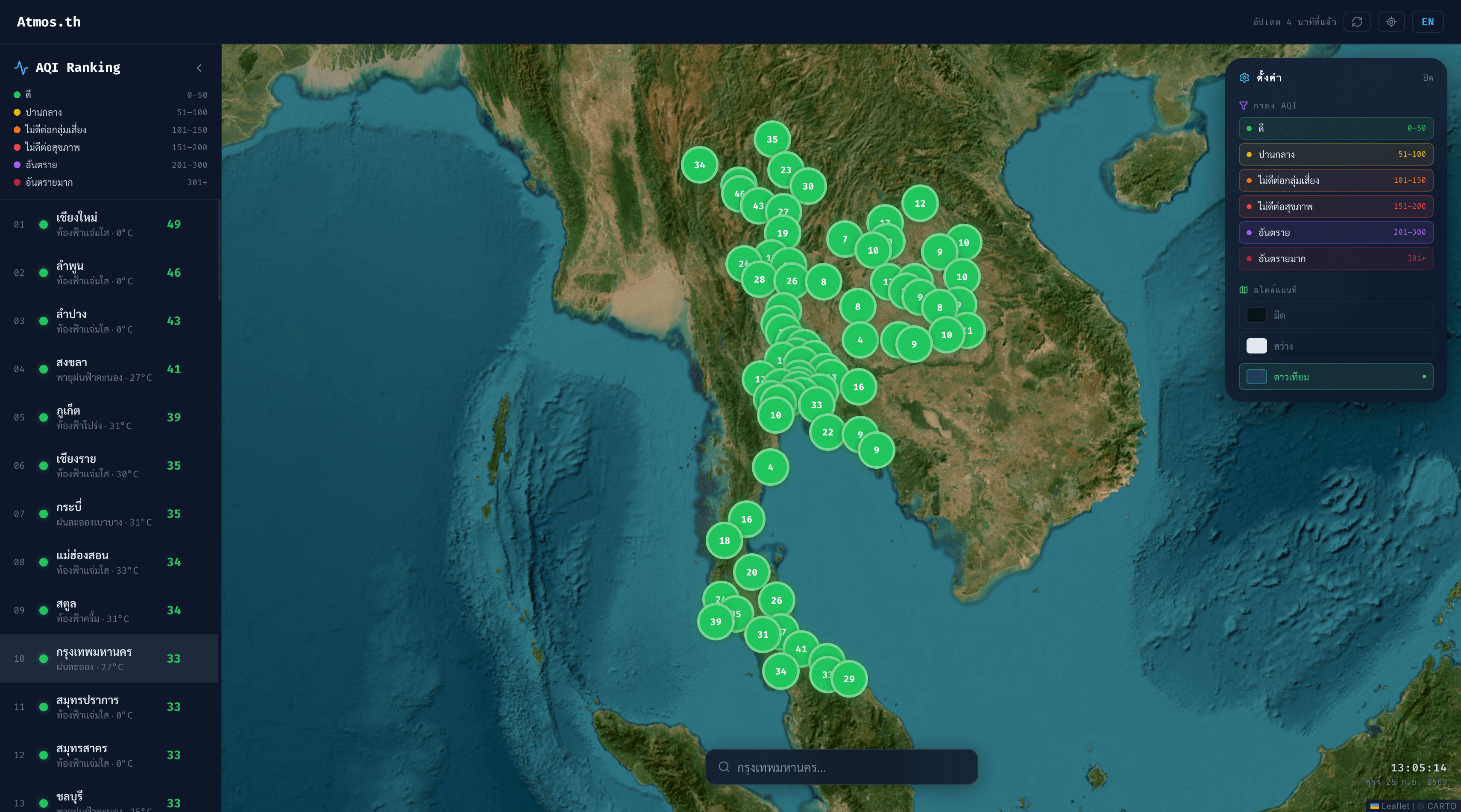
Atmos.th is a real-time air quality and weather map covering all 77 of Thailand's provinces. It turns PM2.5 readings into US EPA AQI, ranks every province, and adds a 7-day forecast, a next-24-hour PM2.5 outlook, and a live rain radar. It runs entirely in the browser on free public APIs, with no backend, in Thai and English.
Features
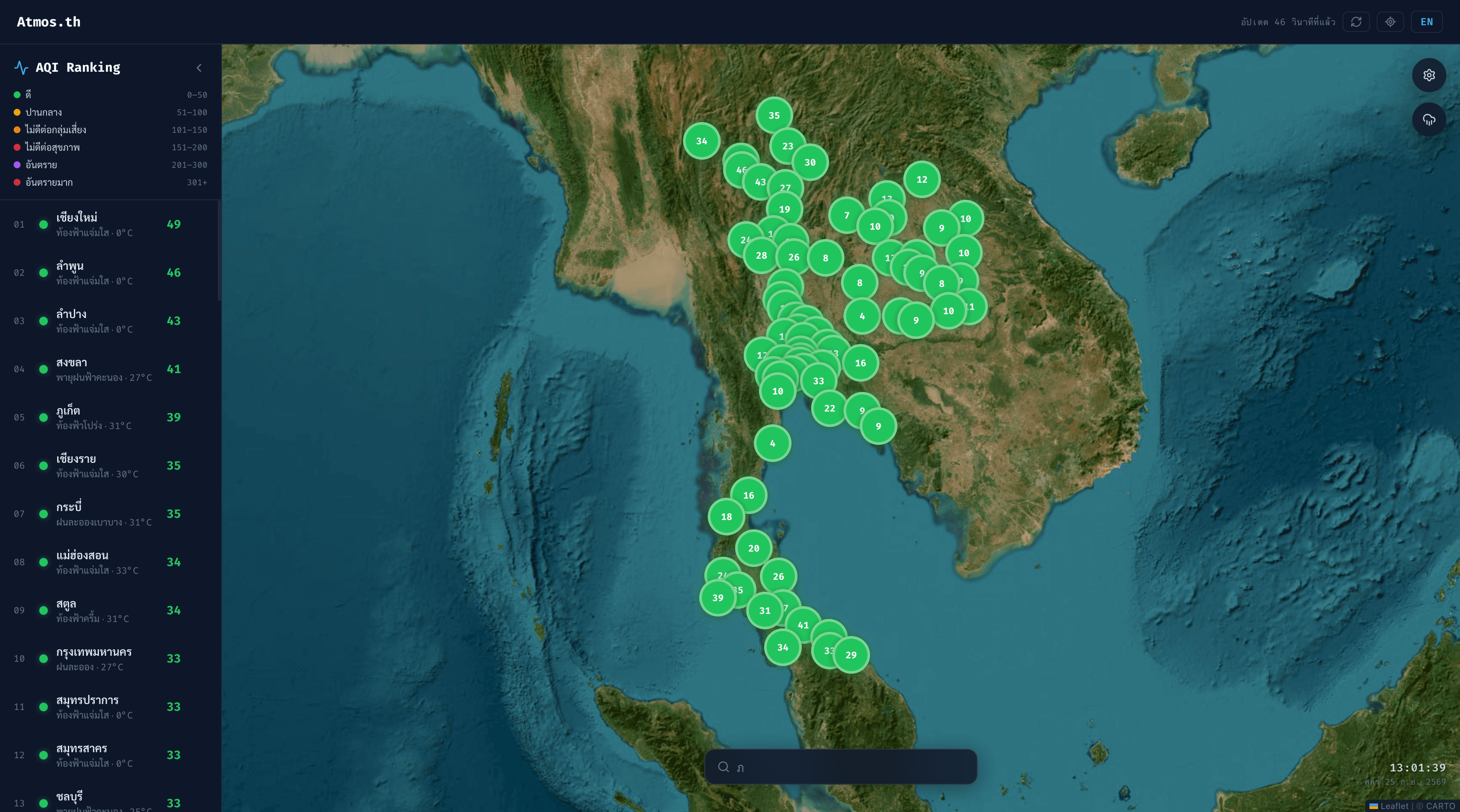
Nationwide AQI Map
AQI markers for all 77 provinces, colour-coded by US EPA level from Good to Hazardous. Zoom with the mouse or the keyboard (+, −, 0).
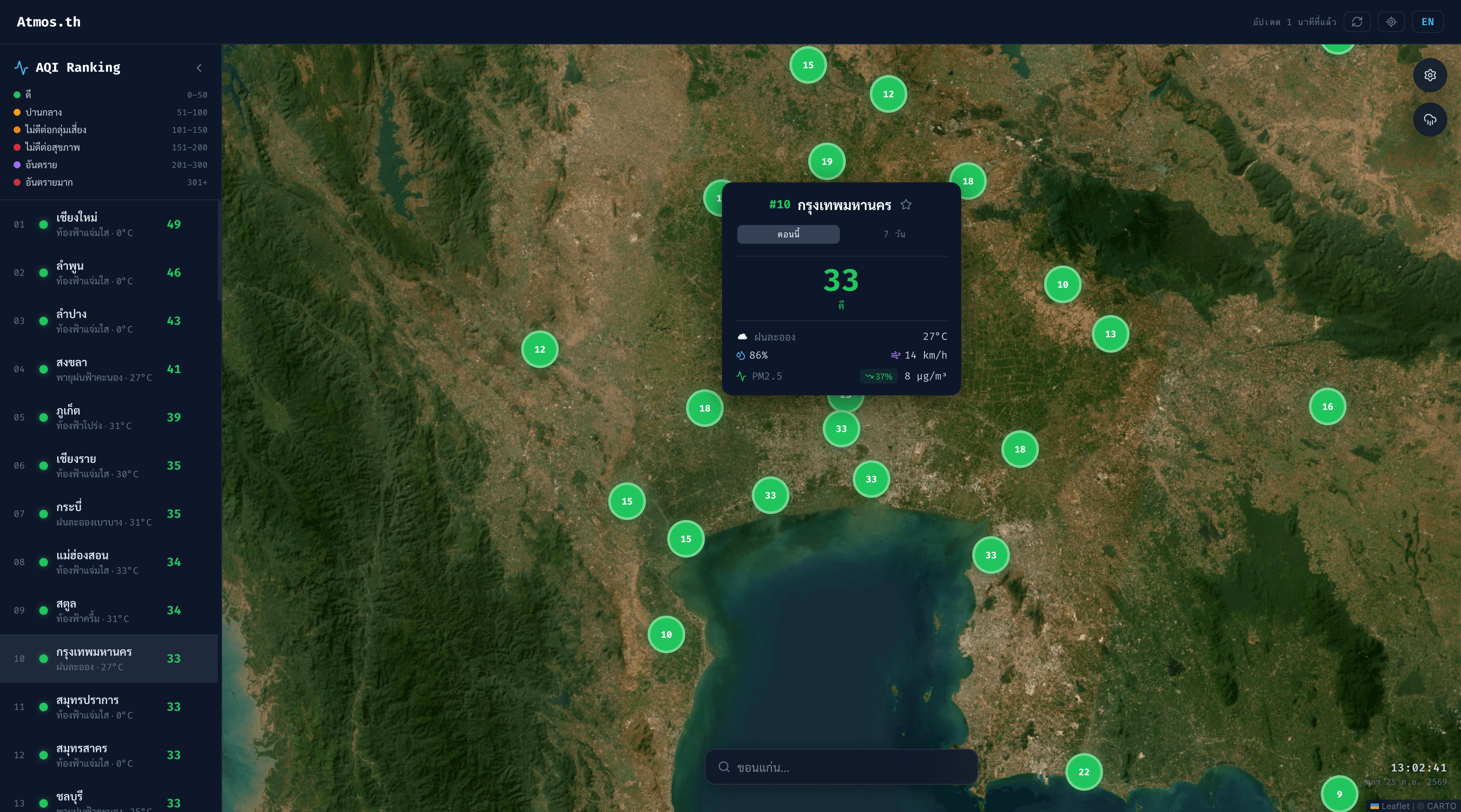
Province Details
Each province shows AQI, PM2.5, weather, temperature, humidity, and wind, plus a trend badge comparing PM2.5 with its 24-hour average.
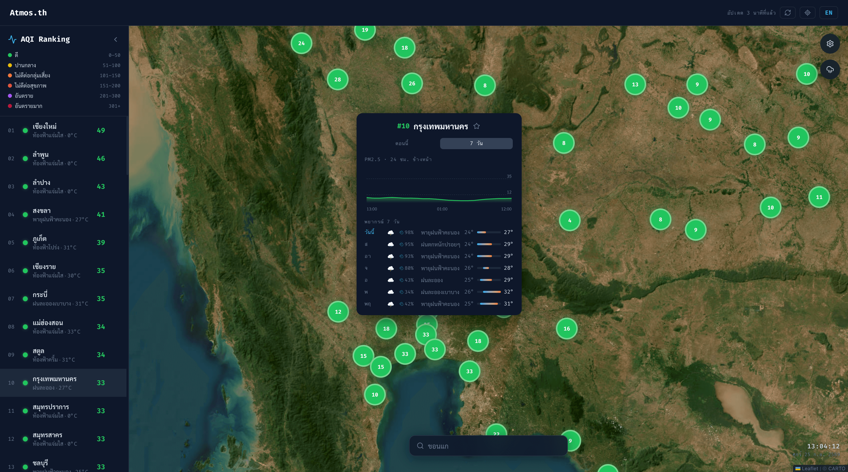
7-Day Forecast
An interactive next-24-hour PM2.5 chart and a 7-day outlook with weather, rain chance, and daily high and low temperatures.
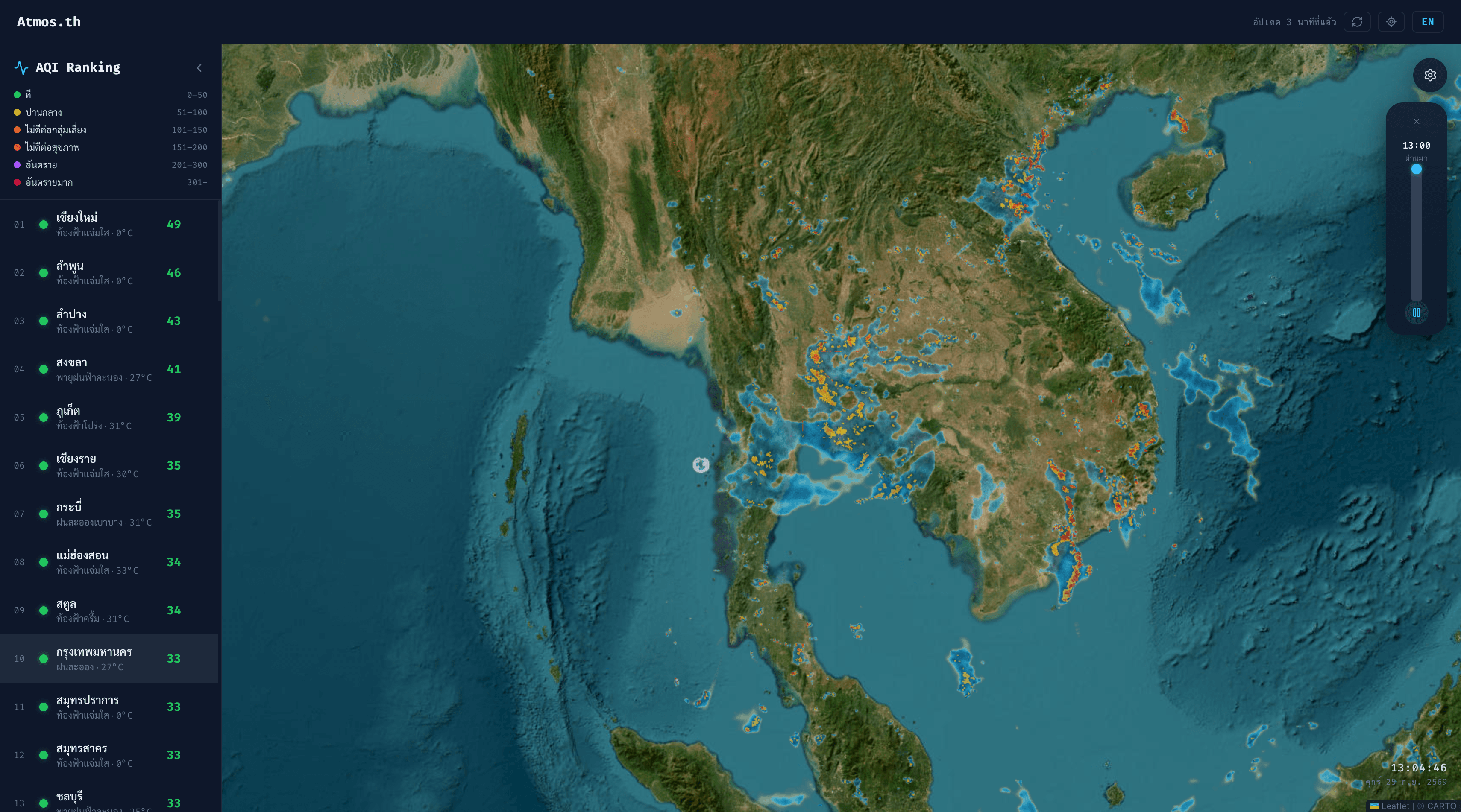
Live Rain Radar
A RainViewer radar layer with past and nowcast frames, a timeline slider, and playback. It tells you when there is no rain nearby.
Ranking & Favorites
A collapsible sidebar ranks provinces from worst to best air. Pin favorites to the top (saved in the browser) and move through the list with the arrow keys.
Search & Locate Me
Search for a province and fly straight to it, or find the nearest one with geolocation. If location access is blocked, the app shows how to turn it back on.